Property Record
302 Parker Dr, Beaufort, SC 29906
This Property Is For Sale
NEARBY LISTINGS FOR SALE OR LEASE
-
-
View all Beaufort listings for sale on LoopNet.com
Property Detail
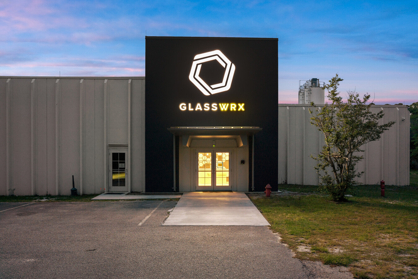
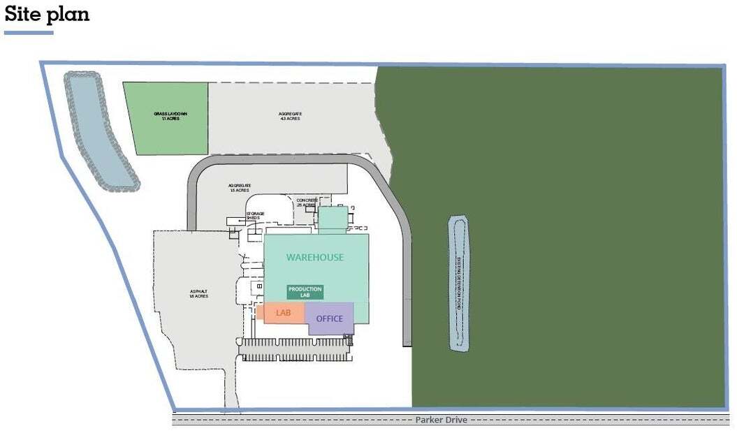
302 Parker Dr
Other Market Areas
Laurel Bay Commercial & Mixed
Hilton Head Island-Bluffton-Beaufort, SC
Beaufort
R120-025-000-0170-0000
South Carolina
Processingplant
35.70 AC
85,127 SF
Hilton Head/Beaufort
DEMOGRAPHICS near 302 Parker Dr
1 Mile
3 Mile
5 Mile
2024 Total Population
964
10,760
28,085
2029 Population
1,065
11,864
30,886
Pop Growth 2024-2029
+ 10.48%
+ 10.26%
+ 9.97%
Average Age
36
34
36
2024 Total Households
346
3,914
10,050
HH Growth 2024-2029
+ 10.12%
+ 9.86%
+ 10.20%
Median Household Inc
$50,128
$52,550
$52,928
Avg Household Size
2.60
2.60
2.50
2024 Avg HH Vehicles
2.00
2.00
2.00
Median Home Value
$173,749
$173,199
$232,556
Median Year Built
1994
1991
1993
Nearby Places
- Restaurants
- Banks
- Shops
- Fitness
- Groceries
PUBLIC TRANSPORTATION
AIRPORT
Hilton Head
DRIVE
WALK
Distance
Hilton Head
56 min
39.7 mi
Freight Ports
Georgia Ports - Savannah
DRIVE
WALK
Distance
Georgia Ports - Savannah
66 min
49.1 mi
Nearby Properties
Address
Land Use
TOTAL SIZE
Lot Size
Zoning
Address
Land Use
TOTAL SIZE
Lot Size
Zoning
4,613 AC
6601
Address
Land Use
TOTAL SIZE
Lot Size
Zoning
217,792 SF
60 AC
6611
Address
Land Use
TOTAL SIZE
Lot Size
Zoning
944.23 AC
6601
Address
Land Use
TOTAL SIZE
Lot Size
Zoning
60,814 SF
3 AC
Address
Land Use
TOTAL SIZE
Lot Size
Zoning
44,312 SF
1.87 AC
Address
Land Use
TOTAL SIZE
Lot Size
Zoning
71,965 SF
20 AC
6611
Address
Land Use
TOTAL SIZE
Lot Size
Zoning
64,000 SF
5.92 AC
Address
Land Use
TOTAL SIZE
Lot Size
Zoning
192 SF
368 AC
6111
Address
Land Use
TOTAL SIZE
Lot Size
Zoning
17,432 SF
7.15 AC
6611
Address
Land Use
TOTAL SIZE
Lot Size
Zoning
5,990 SF
2 AC
Address
Land Use
TOTAL SIZE
Lot Size
Zoning
49,216 SF
7.06 AC
6611
Address
Land Use
TOTAL SIZE
Lot Size
Zoning
9,609 SF
1.49 AC
Address
Land Use
TOTAL SIZE
Lot Size
Zoning
37,452 SF
0.66 AC
6101
Address
Land Use
TOTAL SIZE
Lot Size
Zoning
37,452 SF
0.66 AC
6101
Address
Land Use
TOTAL SIZE
Lot Size
Zoning
21,559 SF
1.82 AC
6611
Address
Land Use
TOTAL SIZE
Lot Size
Zoning
59,100 SF
5.13 AC
6611
Address
Land Use
TOTAL SIZE
Lot Size
Zoning
12,444 SF
2.59 AC
6611
Address
Land Use
TOTAL SIZE
Lot Size
Zoning
117.17 AC
9999
Address
Land Use
TOTAL SIZE
Lot Size
Zoning
35.83 AC
Address
Land Use
TOTAL SIZE
Lot Size
Zoning
35.83 AC
Address
Land Use
TOTAL SIZE
Lot Size
Zoning
16,002 SF
10.30 AC
6611
Address
Land Use
TOTAL SIZE
Lot Size
Zoning
4,302 SF
7.50 AC
6611
Address
Land Use
TOTAL SIZE
Lot Size
Zoning
34,124 SF
8.30 AC
6611
Address
Land Use
TOTAL SIZE
Lot Size
Zoning
10,040 SF
20.53 AC
6611
Address
Land Use
TOTAL SIZE
Lot Size
Zoning
10,043 SF
3 AC
Address
Land Use
TOTAL SIZE
Lot Size
Zoning
41,439 SF
27.75 AC
6611
Address
Land Use
TOTAL SIZE
Lot Size
Zoning
34,450 SF
10.07 AC
6601
Address
Land Use
TOTAL SIZE
Lot Size
Zoning
2,250 SF
1.59 AC
6611
Address
Land Use
TOTAL SIZE
Lot Size
Zoning
113 SF
16.85 AC
6611
The World's #1 Commercial Real Estate Marketplace
Connect with us
© 2025 CoStar Group
The information above has been obtained from sources believed reliable. While we do not doubt its accuracy we have not verified it and make no guarantee, warranty or representation about it. It is your responsibility to independently confirm its accuracy and completeness. Any projections, opinions, assumptions, or estimates used are for example only and do not represent the current or future performance of the property. The value of this transaction to you depends on tax and other factors which should be evaluated by your tax, financial, and legal advisors. You and your advisors should conduct a careful, independent investigation of the property to determine to your satisfaction the suitability of the property for your needs.